1 min read

The Krios River flows from the area of Chionistra in the Troodos Mountains, in a direction towards the south and crosses Pano Platres and Kato Platres from the east.

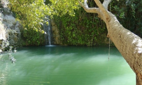
It creates a green valley with unique fauna and flora as well as waterfalls. Along its path it creates the Caledonia Waterfalls as well as the Millomeri Waterfalls which are the most famous ones on the island. Many tourists and locals visit the waterfalls and walk along the various nature trails in the area. The water flow is constant, with increases and decreases according to the weather conditions.

The river is a source of life for the community of Platers as well as other surrounding communities. The Krios River pours into the delta that is formed at the Kouris River along with other smaller river, creating the famous Kouris River and finally pouring into the Kouris Dam.

Krios River, Cyprus location map: 

Near Krios River, Cyprus

Other places within a short drive, closest first.
Nearby Places and things to do (within 5 km radius)

Nicosia

Athalassa Botanical Garden

The Athalassa Botanical Garden is the oldest garden, which was designed and created by the Forest Department.

Athalassa Picnic Site

The Athalassa Picnic Site is located 8 kilometres from the centre of Nicosia in the Athalassa National Forest and 500 metres from Latsia. Altitude: 160 metre

Nicosia

Agios Georgios Picnic Site

The Agios Georgios Picnic Site is located 7 kilometres from the centre of Nicosia, at the Athalassa National Park. Altitude: 160 metres. Capacity: 350 peo

Nicosia

Athalassa National Forest Park

Athalassa National Forest Park is one of the most valuable natural areas in Cyprus and one of the most important green spaces near the capital city of Nicosia.

Nicosia

Agios Georgios Nature Trail

Location: Agiou Georgiou Dam – Aglantzia District: Nicosia Starting Point: Parking areas at the Agios Georgios Dam, with access from the Aglantzia – Geri

Pages